

Pira Aurélien
Cet article est disponible en français
- Team : DPL
- Status : PhD
- aurelien.pira"at"univ-lr.fr
Doctoral thesis (2022-2025)
Doctoral school 618 Euclid
Original training:
- Master’s Degree in Coastal Geosciences and Geophysics - University of La Rochelle, France (2020–2022)
- Bachelor’s Degree in Earth and Atmospheric Sciences - University of Quebec at Montreal (UQAM), Canada (2019–2020) (Completed during an exchange program as part of my undergraduate studies)
- Bachelor’s Degree in Earth Sciences - University of La Rochelle, France (2017–2020)
(2022-2025) GNSS Reflectometry applied to high-frequency sea level monitoring and extreme event detection in hostile coastal environments
Keywords : GNSS reflectometry, geodesy, tide gauges, sea level variations
Scientific managers :
– Dr. Guy Wöppelmann
Professor and Researcher in Geosciences
University of La Rochelle / CNRS, LIttoral ENvironnement et Sociétés (LIENSs, UMR 7266)
Research topics: vertical land motion, sea level variations, space geodesy.
– Dr. Álvaro Santamaría-Gómez
Professor and Researcher in Space Geodesy
CNRS / University of Toulouse III - Paul Sabatier, Géosciences Environnement Toulouse (GET, UMR 5563) and Centre National d’Études Spatiales (CNES)
Research topics: Earth’s deformation, GNSS time series analysis, GNSS methodologies, GNSS reflectometry applied to tide gauge leveling.
GNSS Reflectometry applied to high-frequency sea level monitoring and extreme event detection in hostile coastal environments
Recent studies have shown that GNSS-R can achieve centimeter-level precision over monthly timescales, making it attractive for initiatives like GLOSS, which recommend sea level measurements with better than 1 cm accuracy and sampling intervals of one minute or less. However, conventional GNSS-R techniques are limited by low and irregular temporal resolution, making them unsuitable for high-frequency monitoring.
My research focuses on developing an Extended Kalman Filter (EKF)-based GNSS-R retrieval algorithm designed for continuous estimation of sea surface reflection heights at the native GNSS observation rate, up to one-second intervals. Although currently applied in post-processing, the method is structured for future real-time implementation. By integrating multi-constellation GNSS data and tidal modeling, it enables robust and accurate tracking of sea level variations even under dynamic environmental conditions.
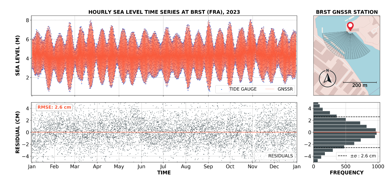
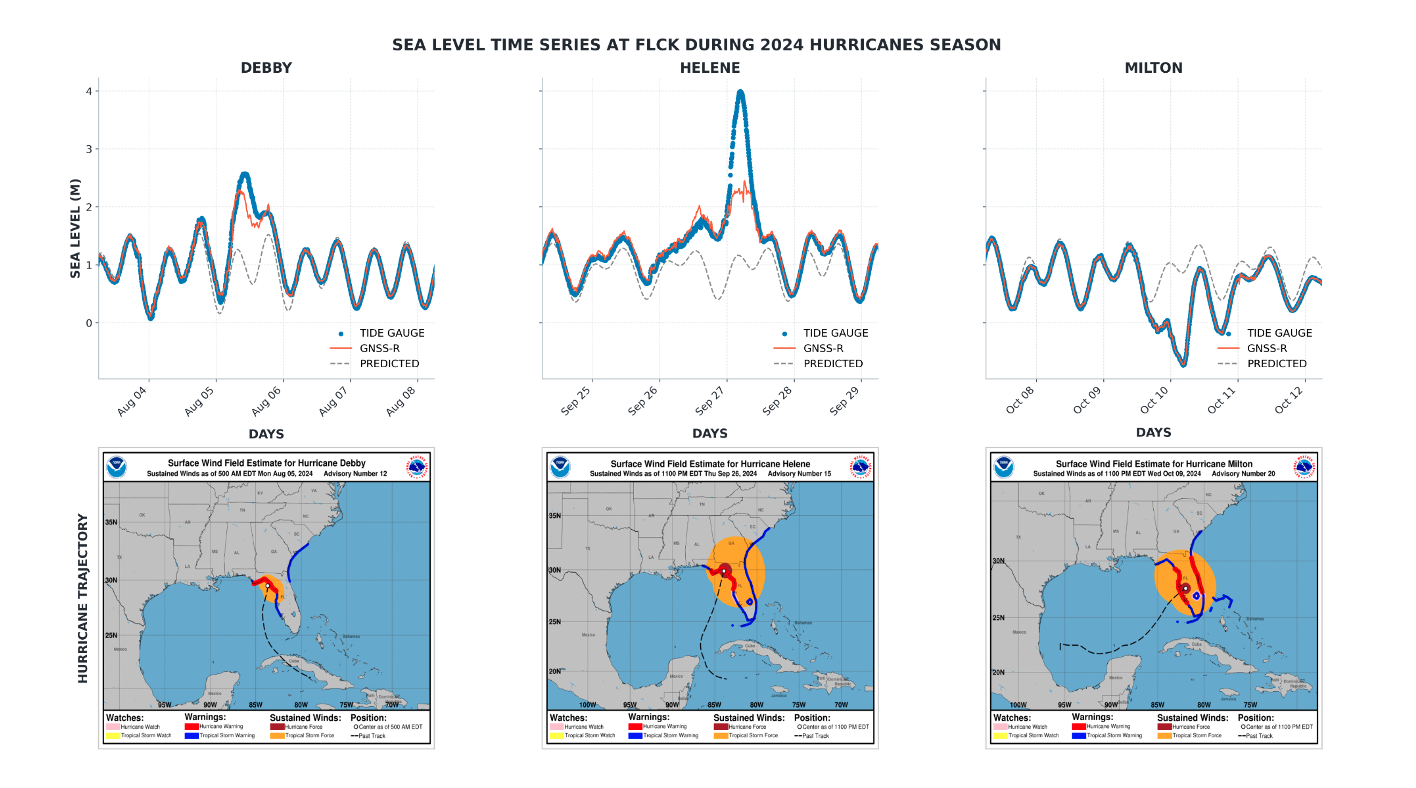
The algorithm was validated using one year of data collected at three coastal sites with contrasting hydrodynamic conditions: Brest (Atlantic coast, France), Sète (Mediterranean coast, France), and Cedar Key (Florida, USA). Across these sites, the GNSS-R retrievals achieved root mean square errors (RMSE) ranging from 2.4 to 2,6 cm (ex. Fig.2) when compared to reference tide gauge measurements. The method successfully captured both regular tidal signals and rapid, storm-induced sea level anomalies, including during the 2024 hurricanes season at Cedar Key (Fig.3).
Main collaborations :
- Géosciences Environnement Toulouse (GET), UMR CNRS / URD /CNES / Université Toulouse 3
- Système d’Observation du Niveau des Eaux Littorales (SONEL)
Publications :