

Publications
https://www.mdpi.com/2072-4292/8/5/387
Drones aériens
- N. Volto, N. Lachaussee, T. Guyot, X. Bertin, N. Long, 2022. Plus-value des drones RTK pour le suivi des évolutions morphologiques du littoral. XVIIèmes Journées Nationales Génie Côtier– Génie Civil, Oct 2022, Chatou, France. pp.495-502, ⟨10.5150/jngcgc.2022.051⟩
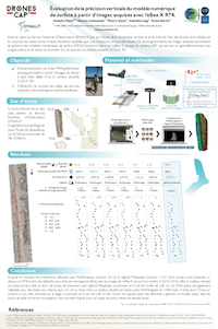
- N. Volto, N. Lachaussee, T. Guyot, N. Long, X. Bertin, 2021, Évaluation de la précision verticale du modèle numérique de surface à partir d’images acquises avec l’eBee X RTK. Journées Drones & Capteurs embarqués, Sep 2021, Saint-Pierre-d’Oléron, France. 8, 2021, Poster ⟨10.3390/rs8050387⟩. ⟨hal-03401093v1⟩
 Cliquer pour agrandir
 - N. Long, B. Millescamps, B. Guillot, F. Pouget, X. Bertin, 2016, Monitoring the topography of a dynamic tidal inlet using UAV imagery, Remote Sensing, Special Issue Remote Sensing in Coastal Environments, 8 (5), 387 ; doi:10.3390/rs8050387.
- N. Long, B. Millescamps, F. Pouget, N. Lachaussee, A. Dumon, X. Bertin, 2016, Accuracy assessment of coastal topography derived from UAV images, The International Archives of the Photogrammetry, Remote Sensing and Spatial Information Sciences, Volume XLI-B1, 2016 XXIII ISPRS Congress, 12–19 July 2016, Prague, Czech Republic.
- E. Chaumillon, L. Chaumillon, B. Millescamps, X. Bertin, N. Long , 2016, Mesures couplées par drone et sondeur interférométrique pour révéler les évolutions morphologiques à haute fréquence d’une embouchure tidale, 25ème Réunion des Sciences de la Terre, 24-28 Octobre 2016, Caen, France, Poster.
- N. Long, B. Millescamps, F. Lévêque, N. Lachaussee, F. Pouget, X. Bertin, 2016, Génération d’un MNT à partir d’images acquises par drone : à quelle précision verticale peut-on prétendre ?, Colloque Photogrammétrie Numérique et Perception 3D : les Nouvelles Conquêtes, 15-17 Mars 2016, Marne-La-Vallée, France, Poster.
Drone marin
- T. Coulombier, V. Ballu, P. Pineau, N. Lachaussée, E. Poirier, A. Guillot, M. Calzas, C. Drezen, L. Fichen, X. Bertin, C. Plumejeaud, V. LeFouest, I. Brenon, G. Wöppelmann, L. Testut, PAMELi, un drone marin de surface pour étudier le littoral de façon interdisciplinaire, Paralia 15, 337–344. https://doi.org/DOI:10.5150/jngcgc.2018.038
- V.Ballu et toute l’équipe PAMELi, Présentation du projet PAMELi lors du colloque “Risques Côtiers : adaptations aux changements climatiques
- C. Chupin, V. Ballu, L. Testut, Y-T. Tranchant, M. Calzas, E. Poirier, T. Coulombier, O. Laurain, P. Bonnefond and FOAM project team, Mapping sea surface height using new concepts of kinematic GNSS intruments, Remote Sensing, 2020
publie le lundi 30 mars 2026